Final project(UAS data mapping mission)
Required for the mission:
- Mobile
device with supporting mission planning software
- A UAS Platform/Sensor of your choice
I was asked to fly an assigned mission plot at PWA with this parameter.
- Altitude: 122m
- Lateral and Frontal Overlap: 80%
Use the search function to find and open the Add Z Information (3D Analyst Tools) tool. This tool calculates properties of 3D shapes and appends the result to the attribute table of the input feature class. In this step, you will calculate the length of each sight line. Set the following parameters: Input Features: LOS_Lines Output Property: 3-Dimensional Length
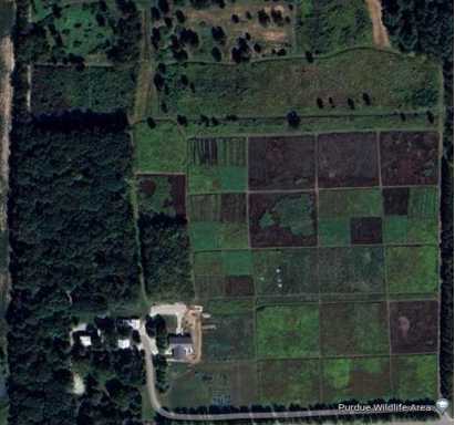
The purpose of this project is to conduct a UAV mission to collect aerial
imagery and data for a specific area at PWA(Purdue wildlife Area). The mission
area has been assigned and the goal was to fly the assigned mission area while
ensuring that the flight boundaries are slightly larger than the assigned area
to ensure complete coverage. The Pilot(Jinwook paek) and my visual observer(Luke
tatalovich) flew a Mavic 2 pro and collected the data at 122 meters with the
setting of Lateral and Frontal Overlap: 80%. It was important to gather as much metadata as possible during the field
mission. This includes information such as pilot(s), mission area, conditions,
sensor, platform, altitude, and the coordinate system data collected in.
Several map products need to be created from the gathered data, including a
locator map, mission orthomosaic, shaded DSM, side-by-side comparison of the
orthomosaic and shaded DSM, digitized roads, digitized polygons of differing
landcovers, classification of land covers (at least 3 classes), and a map
showing training samples used in the classification. Additionally, a reclassed
DSM showing all objects higher than 6 meters should be included. An analysis
should be conducted to find all areas within 20 meters from the digitized roads
layer that contain trees taller than 10 meters.
Purdue
Wildlife Area(PWA)
PWA provides
290 acres of land for educational, extension, and research activities in
Tippecanoe County. PWA is primarily managed to maintain and enhance its current
wetland/savannah/prairie ecosystem which is part of the Indian Creek watershed.
We ran into
many trials and errors in terms of collecting data, the first attempt was on
04/24. We tried to do a 2D scan with Mavic 2 pro by using pix 4D GRID.
Everything worked well, but our controller got a system error message, and it
didn’t start a mission in the first place. So, we changed our plan to use
Skydio. We returned a Mavic and checked out Skydio and went back to PWA. We
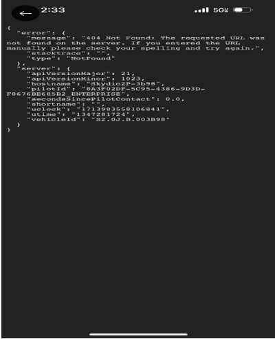
used Skydio’s 2d map scan to collect the data by setting pillars manually. It
took almost one hour (setting pillars, processing time) but when the percentage
of the scan results reached 100%, it showed us this error message that we have
never seen.
That was our second attempt. After getting back to the airport, we tried to figure out why we got these errors by updating the firmware and downloading Pix 4D pro not only Pix4D. and planned a mission on 04/25. We went to PWA again on 04/25 with Mavic 2 pro and we found out why we got a system error, the reason why we got a system error was we didn’t take off before starting a mission in Pix 4D. The error was not from the old version of Pix 4D or SD cards problem. We should’ve taken off before starting a mission in Pix 4D. That was our third attempt and we ended up scanning the PWA successfully.
Initial processing
Pointcloud and mesh
DSM, orthomosaic and index
Comparsion of the orthomosaic and shaded DSM
Classification of land covers
Training samples used in the classification
PWA analysis map


.PNG)
.PNG)
.PNG)


Comments
Post a Comment